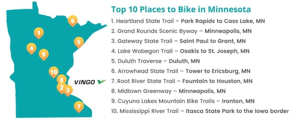
Top 10 Bike Trails in Minnesota
- 1. Heartland State Trail – Park Rapids to Cass Lake, MN
- 2. Grand Rounds Scenic Byway – Minneapolis, MN
- 3. Gateway State Trail – Saint Paul to Grant, MN
- 4. Lake Wobegon Trail – Osakis to St. Joseph, MN
- 5. Duluth Traverse – Duluth, MN
- 6. Arrowhead State Trail – Tower to Ericsburg, MN
- 7. Root River State Trail – Fountain to Houston, MN
- 8. Midtown Greenway – Minneapolis, MN
- 9. Cuyuna Lakes Mountain Bike Trails – Ironton, MN
- 10. Mississippi River Trail – Itasca State Park to the Iowa border
- Interested in another state?
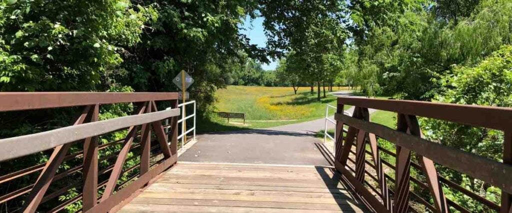
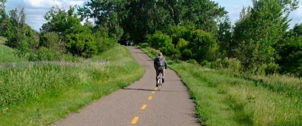
Minnesota is a cyclist’s paradise, featuring stunning landscapes, plenty of lake views, and incredible trails of varying difficulty. Check out some of these top-rated trails in the North Star State.
1. Heartland State Trail – Park Rapids to Cass Lake, MN
The Heartland State Trail is a rail trail spanning 49 miles through north-central Minnesota, from Park Rapids to Cass Lake. This bike route leads you through dense forest and past several lakes, rivers, and streams, some of which are accessible from the trail if you’re feeling adventurous. You’ll also pass several public beaches and campgrounds along the route, making for fun side trips. The trail grazes the edge of Paul Bunyan State Forest and Chippewa National Forest, offering a chance to explore these gorgeous wildlife areas, too.
Parking and trail access to the Heartland State Trail is located in Park Rapids, Dorset, Nevis, Akeley, Walker, Erickson’s Landing, and Cass Lake.
Tips: If you’re heading north from Walker toward Cass Lake on the Heartland State Trail, a four-mile segment of the trail departs from the former railroad route and becomes much hillier! So be ready for a more challenging ride here.
2. Grand Rounds Scenic Byway – Minneapolis, MN

The Grand Rounds Scenic Byway is a 51-mile scenic byway that connects lakes, parks, green spaces, and the Mississippi River into one convenient loop that cyclists can enjoy. The system of trails consists of seven different segments:
- Downtown Riverfront: 1.2 miles
- Chain of Lakes: 13.3 miles
- Minnehaha: 12.6 miles
- Mississippi River: 9.2 miles
- Northeast: 6 miles
- Victory Memorial: 3.8 miles
- Theodore Wirth: 4 miles
Along the way, there are informational kiosks, interpretive sites, and popular attractions, including St. Anthony Falls and the Stone Arch Bridge, which offer panoramic views of the falls. While you bike this popular route, you can also check out one of the most popular sites in Minneapolis, Minnehaha Falls, a stunning 53-foot waterfall. Or, stop by the Weisman Art Museum, which offers free daily admission.
Fortunately, getting to the Grand Rounds Scenic Byway is easy. There are more than 20 access points from various interstates and thoroughfares in the Minneapolis area.
Tips: Since there’s so much to see and do along this trail, it’s a good idea to plan your riding route ahead of time. Whether you bike a portion of the trail or the entire 51 miles, you’re bound to enjoy every minute of it.
3. Gateway State Trail – Saint Paul to Grant, MN
The Gateway State Trail is an 18-mile trail that begins in Saint Paul and heads northeast through the rural landscape outside the city. The paved path was built on an old railroad, so it’s primarily flat, making for an easy and leisurely ride. Along the way, you’ll pass several urban areas and parks, and as you continue out of the city, you’ll pass lakes, wetlands, fields, and more in Ramsey and Washington Counties. If you start your ride in Grant and head toward Saint Paul, the trail will also provide easy access to downtown and the State Capitol Complex.
Parking and trail access is available along many city streets that pass the trail and at several other areas listed on the Minnesota Department of Natural Resources website.
Tips: The Gateway State Trail also connects to several local and regional trails, including Phalen-Keller Regional Park and the Bruce Vento Regional Trail.
4. Lake Wobegon Trail – Osakis to St. Joseph, MN
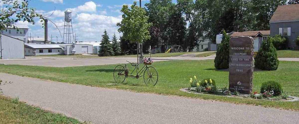
Lake Wobegon Trail is a 65-mile Minnesota wonder, named for the fictional town of Lake Wobegon, made famous by Garrison Keillor of A Prairie Home Companion. The trail sits on an old railroad corridor featuring scenic views of the area’s prairie, lakes, woodlands, and farmland. Much of the route parallels I-94 and passes through the state’s top-producing dairy county and seven small communities. While you ride, you’ll pass several interesting attractions, including Saint John’s University, Minnesota’s longest covered bridge in Holdingford, and Melrose’s historic St. Mary’s Church and Rectory and Melrose Area Museum. Lake Wobegon Trail ends in Osakis, where it offers a convenient connection to the 55-mile Central Lakes State Trail.
Trail access and parking are available off I-94 and in St. Joseph, Holdingford, Albany, and most other towns along the route.
Tips: For an enjoyable side trip, consider stopping in Freeport, just west of Albany. It’s the birthplace of Lake Wobegon and was Garrison Keiller’s inspiration for some of his fictional places.
5. Duluth Traverse – Duluth, MN

The Duluth Traverse (also known as the DT) is a system of singletrack natural surface trails for mountain bikes that links neighborhoods, green spaces, parks, and all the mountain biking trails in Duluth. When completed, it will be the first 100-mile trail system of its kind, entirely in an urban setting. Although it’s intended for mountain bikes, cyclists also share the trails with runners, joggers, snowshoers, backcountry skiers, and other pedestrians.
You can easily access the Duluth Traverse trails from several parks and green spaces across Duluth, including Lester Park, Piedmont-Brewer Park, Mission Creek, Hartley Park, and Spirit Mountain Recreation Area.
Tips: If you’re out riding the DT in the summer, check out Lester Park, situated between Amity Creek and Lester River. It’s the perfect route for both beginners and experienced cyclists, the views are excellent, and you can cool off with a swim in the Lester River when you’ve finished your ride.
6. Arrowhead State Trail – Tower to Ericsburg, MN
The Arrowhead State Trail is a massive 135-mile route for cyclists, snowmobilers, equestrians, and hikers. Although it was developed primarily for winter use and snowboarding, about 69 miles of it are perfect for mountain biking. This trail offers miles and miles of rugged scenic landscape, with the south portion of the route being very hilly and the north section relatively flat. While you ride, you’re also likely to see plenty of wildlife! The area is home to more than 100 varieties of birds as well as moose, white-tailed deer, wolves, black bears, lynxes, porcupines, red squirrels, and more. The Arrowhead State Trail also passes by two of Minnesota’s biggest and most beautiful lakes: Lake Vermillion and Kabetogama Lake.
Parking and trail access are available in Tower, International Falls, and Cook. You can also park and access the trails from the Kabetogama River State Forest campgrounds.
Tips: This trail is very close to the spectacular Voyageurs National Park and Soudan Underground Mine State Park, which are also worth exploring if you have the time!
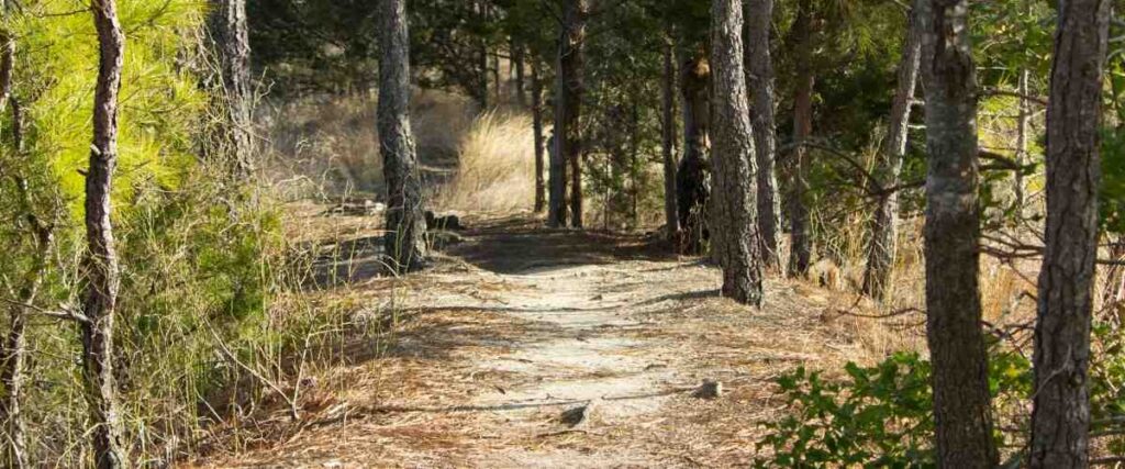
7. Root River State Trail – Fountain to Houston, MN
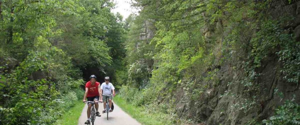
The Root River State Trail is a 42-mile paved bike route in southeastern Minnesota. It follows the Root River and winds through the unique Driftless Region, which was left untouched by glaciers during the last ice age. While the area is known for its steep hills and limestone bluffs, the Root River State Trail follows a former railroad line, so it’s pleasantly flat. As you bike along this gorgeous pathway, you’ll have plenty of opportunities to check out one-of-a-kind attractions, like the giant sinkhole half a mile from the trailhead in Fountain, or Preston’s Mystery Cave, which maintains a temperature of 48 degrees year-round. As the trail winds through the heart of Peterson, you’ll also come face-to-face with the community’s strong Norwegian culture. In Houston, where the trail ends, you can stop and check out the fascinating International Owl Center.
Parking and trail access are available in Fountain, Lanesboro, Peterson, and Houston.
Tips: Between Lanesboro and Fountain, the trail also connects with the 18-mile Harmony–Preston Valley State Trail.
8. Midtown Greenway – Minneapolis, MN

The Midtown Greenway is a 5.5-mile rail trail in Minneapolis that’s separated from the street for most of its distance across the city, offering a traffic-free route for bicyclists. The greenway runs parallel to Lake Street, a commercial strip with shops, restaurants, and other local businesses. The Midtown Greenway is plowed in the winter, well-lit at night, and is open 24/7 to cyclists and pedestrians. By far, it’s the best way to travel through the city and experience Minneapolis! The trail also connects to other paths west and east of the city, including routes along the Mississippi River, the Minneapolis Chain of Lakes, and the Southwest LRT Trail.
The Midtown Greenway is easily accessible throughout various parts of Minneapolis via entrance ramps.
Tips: The Midtown Greenway is a busy and narrow commuter and recreational trail, so if you want to speed train on your bike, this isn’t the best place for it.
9. Cuyuna Lakes Mountain Bike Trails – Ironton, MN
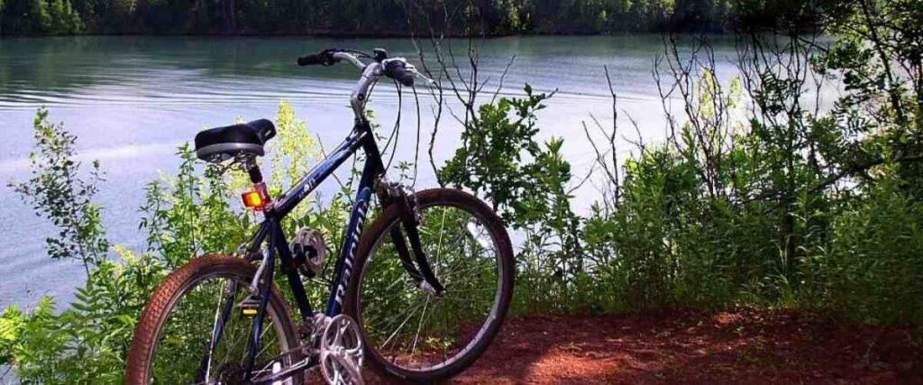
What was once home to the iron ore mines is now the Cuyuna Lakes Mountain Bike Trails, featuring 112 miles of diverse singletrack trails. Known as one of the state’s top mountain biking destinations, the routes at Cuyuna Lakes Mountain Bike Trails cater to cyclists of all abilities. The area also boasts scenic lake views, former mine pits filled with water, and rocky, post-industrial terrain. The most popular trails here are in the Yawkey Trail Unit, but they’re also more advanced. If you want a beginner-friendly trail here, try Galloping Goose. Most of the trail system is family-friendly and well-marked, so you’ll know what you’re getting into before you start riding a particular trail.
Parking and trail access are available at Cuyuna Country State Recreation Area with a permit. Free parking is also available in Ironton on 3rd Street (one block north of Highway 210) and Curtis Avenue. You can easily ride to the Cuyuna Country State Recreation Area from town.
Tips: There is a daily fee to bike at Cuyuna Lakes Mountain Bike Trails, and you’ll need a Minnesota State Park permit to park within the Cuyuna Country State Recreation Area.
10. Mississippi River Trail – Itasca State Park to the Iowa border
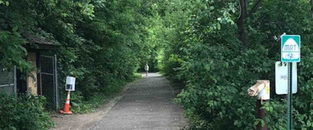
The Mississippi River Trail stretches an astonishing 620 miles down the river from Itasca State Park to the Iowa border. It is a stunning bike ride featuring spectacular views of the Mississippi River, uplands, and the adjoining bottomlands. The route leads cyclists along the shoulders of paved roads, low-traffic roads, and segments of scenic state and regional trails. Overall, the Mississippi River Trail route is relatively flat, with the steepest climb being 578 feet on the Apple Blossom Scenic Byway. Along the way, stop at Black Dog Cafe or visit the Wabasha Street Caves in Saint Paul. Other attractions like the AZ Art Gallery in Saint Paul, Minnehaha Falls in Minneapolis, and Swan Park in Monticello have gained popularity among cyclists passing through.
You can access the Mississippi River Trail from many communities along the route. These route maps will help you plan your route.
Tips: Overall, the Mississippi River Trail is well-marked with signs, but there are a few sections that are not. We highly recommend using a map to navigate this trail!
Interested in another state?
Discover the best US places to ride a bike:
- Alabama
- Arizona
- Arkansas
- California
- Colorado
- Connecticut
- Florida
- Georgia
- Hawaii
- Idaho
- Illinois
- Iowa
- Indiana
- Kansas
- Kentucky
- Louisiana
- Maryland
- Massachusetts
- Michigan
- Minnesota
- Missouri
- Mississippi
- Nebraska
- Nevada
- New Jersey
- New Mexico
- New York
- North Carolina
- Ohio
- Oklahoma
- Oregon
- Pennsylvania
- Rhode Island
- South Carolina
- Tennessee
- Texas
- Utah
- Virginia
- Washington
- West Virginia
- Wisconsin
Tired of hypercompetitive fitness apps?
Enjoy Vingo’s judgment-free community!![]() Explore new worlds on many different terrains
Explore new worlds on many different terrains![]() Personalize your avatar with cool clothes and gears
Personalize your avatar with cool clothes and gears![]() Experience Vingo anywhere on any exercise bike or treadmill
Experience Vingo anywhere on any exercise bike or treadmill
Photo Sources:
National Archives and Records Administration, Public domain, via Wikimedia Commons
McGhiever, CC BY-SA 3.0, via Wikimedia Commons
Beachie2k (talk)beachie2k, Public domain, via Wikimedia Commons
Kstoerz (talk), CC BY-SA 3.0, via Wikimedia Commons
BpA9543, CC BY-SA 4.0, via Wikimedia Commons
McGhiever, CC BY-SA 4.0, via Wikimedia Commons
VikingB, CC BY-SA 4.0, via Wikimedia Commons
References:
- https://www.traillink.com/trail/heartland-state-trail/
- https://www.minneapolisparks.org/parks__destinations/trails__parkways/grand_rounds_scenic_byway_system/
- https://lakewobegontrail.com/about/
- https://www.traillink.com/trail/lake-wobegon-trail/
- https://duluthmn.gov/parks/parks-planning/st-louis-river-corridor/duluth-traverse/
- https://www.dnr.state.mn.us/state_trails/arrowhead/index.html
- https://files.dnr.state.mn.us/maps/state_trails/arrowhead_taconite.pdf
- https://www.traillink.com/trail/root-river-state-trail/
- https://www.dnr.state.mn.us/state_trails/root_river/index.html
- https://midtowngreenway.org/about-the-greenway/overview/
- https://www.cuyuna.com
- https://www.dot.state.mn.us/bike/mrt.html
- https://www.exploreminnesota.com/profile/mississippi-river-trail/5791


