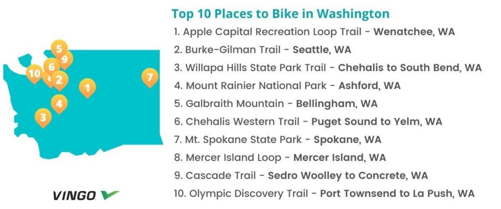
Top 10 Bike Trails In Washington
- 1. Apple Capital Recreation Loop Trail – Wenatchee, WA
- 2. Burke-Gilman Trail – Seattle, WA
- 3. Willapa Hills State Park Trail – Chehalis to South Bend, WA
- 4. Mount Rainier National Park – Ashford, WA
- 5. Galbraith Mountain – Bellingham, WA
- 6. Chehalis Western Trail – Puget Sound to Yelm, WA
- 7. Mt. Spokane State Park – Spokane, WA
- 8. Mercer Island Loop – Mercer Island, WA
- 9. Cascade Trail – Sedro Woolley to Concrete, WA
- 10. Olympic Discovery Trail – Port Townsend to La Push, WA
- Interested in another state?
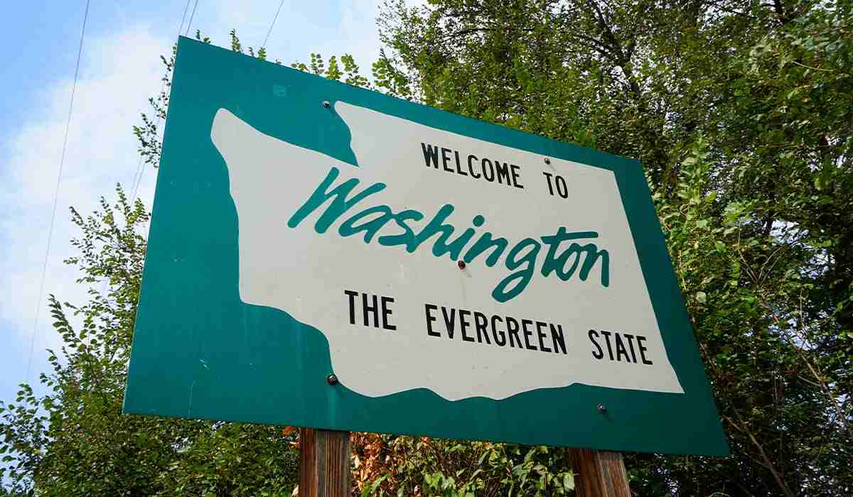
Washington has frequently been named the most bicycle-friendly state in the U.S. Whether you’re riding through the city or taking on the challenging routes at Mount Rainier, there are endless great places to bike. Although there are plenty of options, we’ve compiled a list of ten of the best options for your riding pleasure.
1. Apple Capital Recreation Loop Trail – Wenatchee, WA
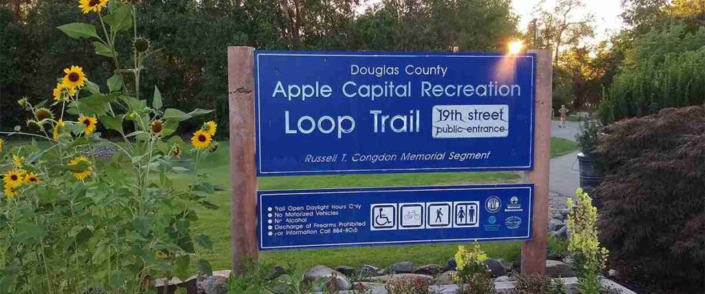
The Apple Capital Recreation Loop Trail features 22 miles of asphalt trail circling the Columbia River. With plenty to see and do, this route has an elevation of about 600 feet for a scenic and gentle ride that everyone can enjoy.
This paved loop stretches along both sides of the Columbia River near Wenatchee, providing residents and visitors with an urban waterfront and a beautiful natural landscape for local wildlife. It runs through four riverfront parks: Wenatchee Riverfront Park, Walla Walla Point Park, the Horan Nature Area, and the Wenatchee Confluence State Park, before crossing the river via the Odabashian Bridge. The East Wenatchee side of the Apple Capital Recreational Loop Trail traces the bluffs, crosses ravines, and features tight hairpin turns for a wilder ride.
To get to this trail, you can park at Walla Walla Point Park. The trail coordinates are 47.4627, -120.3242.
Tips: Walla Walla Point Park also has a swimming lagoon, so it’s a great place to stop and enjoy the water after your ride, especially if you’re out riding during the summer.
2. Burke-Gilman Trail – Seattle, WA
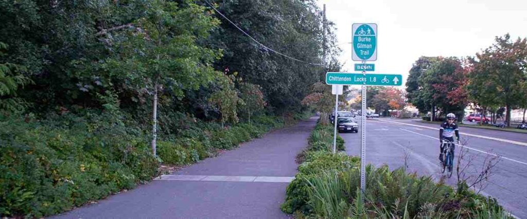
The Burke-Gilman Trail in Seattle is one of the state’s most popular biking routes. Featuring 19 miles of paved rail-trail, this route begins at Puget Sound at the Golden Gardens Park entrance and wraps around the northern tip of Lake Washington to Bothell.
This trail passes the Hiram M. Chittenden Ballard Locks, the busiest locking system in the nation, and leads you through the eclectic and effortlessly cool Ballard and Fremont neighborhoods. As you ride, you’ll also pass through the University of Washington campus and the “U District,” where you’ll find yourself on a beautiful and secluded path of fir, maple, and dogwood trees. At mile 16, you’ll enter the city of Lake Forest Park, which offers a fun lakefront detour at Log Boom Park. To end the ride, you’ll head straight over a bridge into Blythe Park, which has bathrooms, picnic tables, a playground, and more.
To explore the Burke-Gilman Trail, start your ride at Golden Gardens Park (8498 Seaview Pl NW, Seattle, WA 98117) or Blyth Park (16950 W Riverside Dr, Bothell).
Tips: At mile 20, the trail takes you to Blythe Park, or you can veer left onto the Sammamish River Trail, which follows a river through Woodinville’s wine country and connects with the East Lake Sammamish Trail in Marymoor Park, before continuing another 11 miles to Issaquah.
3. Willapa Hills State Park Trail – Chehalis to South Bend, WA
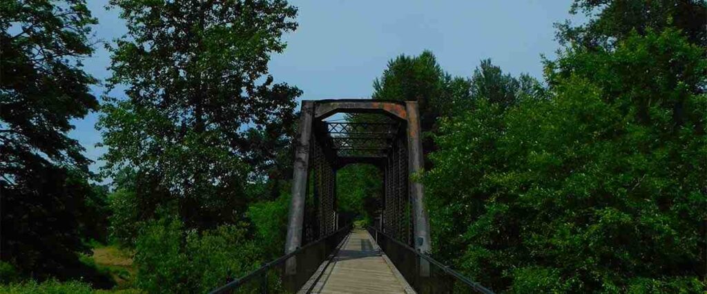
The 56-mile-long Willapa Hills State Park Trail is a complete gem for nature-loving cyclists. Connecting Chehalis in the east with South Bend on the coast, this gravel, dirt, and turf trail is a true adventure. It stretches through remote farmland and forests, over century-old trestles, and through small, quaint towns.
The Willapa Hills State Park Trail in southwestern Washington is a moderate ride with many sights to see along the way. In addition to passing old lumber mill towns, you’ll also pass through Rainbow Falls State Park, a 139-acre camping park on the Skagit River, featuring a waterfall, Fuschia garden, trails, and swimming areas. Many bridges along the route were replaced due to significant flooding in the area in 2007, but much of it still features historic trestles for cyclists to enjoy.
You can access this cycling route from the Chehalis trailhead or the South Bend trailhead, but you’ll need a Discover Pass to park at the Chehalis trailhead.
Tips: This trail easily accommodates small and large groups, with several developed trailheads.
4. Mount Rainier National Park – Ashford, WA
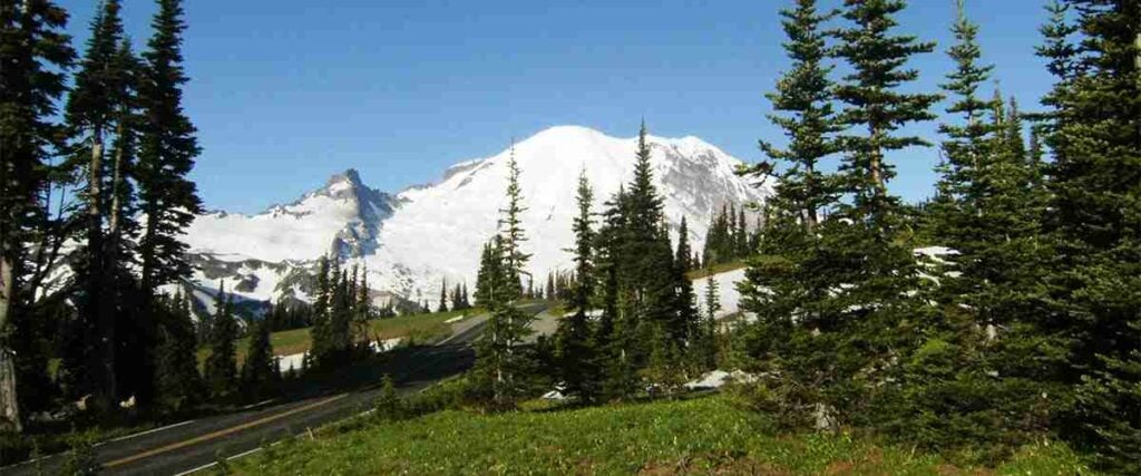
Mount Rainier National Park has many excellent options for adventuring by bike. Gorgeous subalpine wildflower meadows surround this active volcano, and ancient forest lines the lower slopes. Offering challenging and scenic biking routes with unparalleled views, this is one Washington cycling location you won’t want to miss!
There are several challenging route options for cyclists at Mountain Rainier National Park, including Westside Road, a 13-mile gravel route, White River and Sunrise, a 16-mile 3,000-feet climb, and the Carbon River Road, a 5-mile gravel road that’s open to bikers.
To get to Mount Rainier National Park, head to 39000 State Route 706 E, Ashford, WA 98304.
Tips: The summer months are extremely busy at Mount Rainier! September and early October are ideal times for cyclists to visit because the roads are less congested, and the fall colors make the scenery even more beautiful.
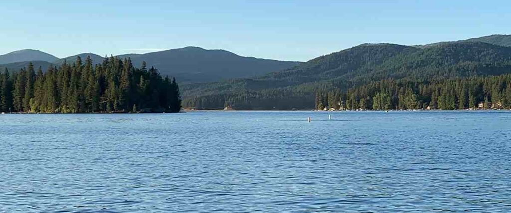
5. Galbraith Mountain – Bellingham, WA
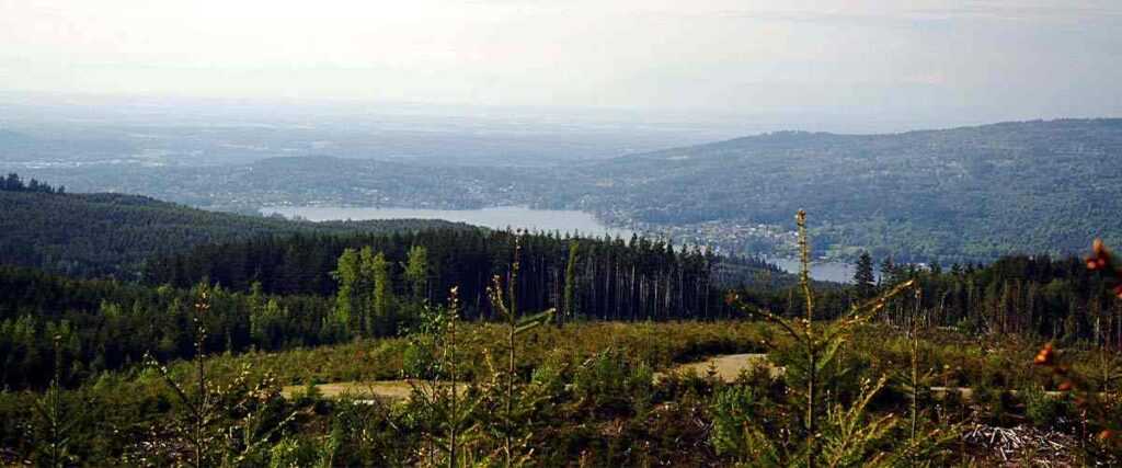
Galbraith Mountain is a well-known mountain biking destination, home to more than 65 miles of singletrack trails. The trails are all built and maintained by the Whatcom Mountain Bike Coalition (WMBC), and they wind through 3,000 acres of land overlooking the city of Bellingham and Bellingham Bay.
The massive network of trails at Galbraith Mountain makes it an ideal mountain biking destination for cyclists of all skill levels. With an elevation gain of 1,785 feet, you’ll enjoy a little bit of everything here. From fast and flowing trails to longer cross country loops and challenging features like jumps and drops, every mountain biker needs to spend a day exploring Galbraith Mountain.
You can get to Galbraith Mountain via the northside or southside entrances. To access the northside entrance, you can park in Whatcom Falls Park and bike to the entrance or head to Birch Street off Lakeway Drive, where you’ll find a parking lot and street parking. The southside entrance has a small parking lot off Samish Way.
Tips: It’s easy to get lost at Galbraith Mountain! Although there are trail kiosks at both entrances of the mountain, the best way to find your way around is to buy a waterproof printed map or purchase a trail map online in PDF form from the WMBC.
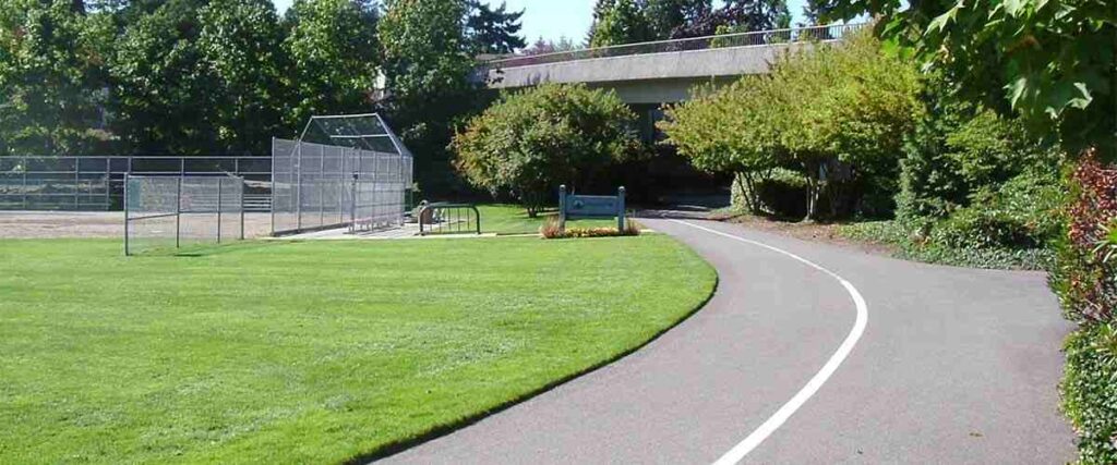
6. Chehalis Western Trail – Puget Sound to Yelm, WA
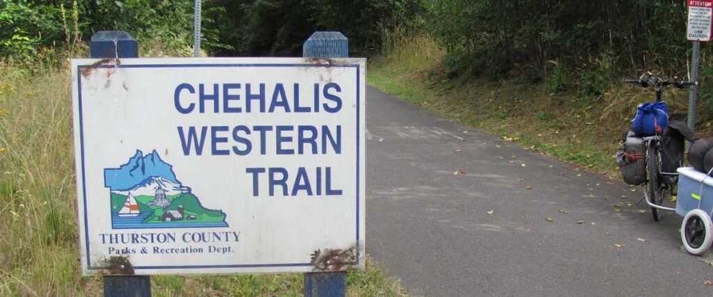
The Chehalis Western Trail is a 22-mile route that follows the course of the former Chehalis Western Railroad. It’s the backbone for trails that link every major town in Thurston County. With widely varying scenery along the route and plenty of opportunities for fun side trips, this is a fantastic bike ride that doesn’t require you to cycle on any busy roads.
The trail’s north end begins at the 900-acre Woodard Bay Natural Resources Conservation Area (NRCA) on Puget Sound. From here, the route takes you through beautiful farmland, forests, and meadows before it reaches Lacey and becomes more suburban. With an elevation gain of 500 feet and access to more than 170 acres of parkland, including the Deschutes River and Chambers Lake, this is the perfect trail for a moderately easy bike ride any time of the year. South of Lacey, the Chehalis Western Trail intersects with the 14.5-mile Yelm-Tenino Trail. Nearby, if you continue on the trail, it passes through the Monarch Contemporary Art Center and Sculpture Park, open daily from dawn to dusk.
The coordinates of the trailhead are 47.0336, -122.8392. You can get there via I-5, exit 109 and the parking area is off 14th Avenue.
Tips: For a great side trip, head to the state capital of Olympia via the 5-mile Woodland Trail Junction in Lacey.
7. Mt. Spokane State Park – Spokane, WA
Mt. Spokane State Park is one of Washington’s largest parks, featuring elevations ranging from 3200 feet to 5774 feet and various mountain biking trails to explore. The courses range from easy to difficult, ensuring that bikers of all skill levels can have a great time exploring this state park on two wheels.
Whether you choose to ride through this area’s beautiful cedar forests, meadows filled with wildflowers, or the high alpine, you’ll enjoy all the trails Mt. Spokane State Park offers. If you’re looking for easier rides, try biking in the Nordic Area, where you’ll find rolling doubletrack with beautiful views of Idaho and Montana. For a challenging ride with a lot of climbing, try cycling to the summit of Mt. Spokane via 140, one of the top bike climbs in Washington! The lower section of the trail is heavily forested along the smooth, paved roadway, but the descent from the top is arguably one of the best you can find anywhere.
You can download maps of these areas and get detailed directions from the Evergreen Mountain Bike Alliance Eastern Washington Chapter.
Tips: You’ll need a Discovery Pass to park, but you can purchase day passes on site. There is no public water access and minimal cell coverage, so come prepared!
8. Mercer Island Loop – Mercer Island, WA
Near Seattle, you can train with the locals on Mercer Island, a well-known suburb with a reputation for affluence and wealth. However, the Mercer Island Loop is open to everyone and anyone that wants to bike it!
The 16.5-mile Mercer Island Loop around the island’s perimeter offers a moderately difficult yet impressively scenic route with minimal traffic. A great ride for bikers of all skill levels, this loop features stunning views of Lake Washington, Mt. Rainier, the Cascade Range, and gorgeous multimillion-dollar homes lining the waterfront. Riding the loop counterclockwise offers the best views of the lake, but cycling clockwise provides a gentler ride with more gradual ascents.
To cycle the loop, you can drive to the island or bike there via I-90.
Tips: Much of this ride is along shared car-bike lanes, but traffic on the island rarely moves very quickly. If you need water, a bathroom, or more information, head to the Veloce Velo bike shop on 77th Avenue. They also offer free parking for cyclists biking the loop!
9. Cascade Trail – Sedro Woolley to Concrete, WA
The 22.5-mile Cascade Trail follows the Skagit River and parallels State Route 20, cutting into the Cascade foothills in northwest Washington. A very scenic ride, the Cascade Trail is a favorite for cyclists of all skill levels.
This trail’s surface is primarily crushed stone and gravel, so it can get pretty bumpy! But the gorgeous views are worth all the bumps along the way. It meanders back and forth along the river and the highway, providing endless views of the surrounding farmland and foothills. As you continue, you’ll bike through beautiful fields and open spaces, woodlands, and riverside areas that provide fishing access and pretty river views. Near mile 19, the Cascade Trail passes through designated land for the Skagit River population of the North Cascades elk herd. You’re likely to catch glimpses of the elk as they wander through Hurn Field, which they call home. If you choose to bike from Sedro Woolley to Concrete, you can continue your ride over the Henry Thompson Bridge from there and enjoy a nice riverside lunch at the Baker River Project and Visitor Center.
You can access this trail from three different trailheads off the North Cascades Highway.
Tips: At mile 14, you can also take a 1-mile detour south to Rasar State Park, an excellent spot for camping and bird watching.
10. Olympic Discovery Trail – Port Townsend to La Push, WA
The Olympic Discovery Trail is a must-do for all cyclists visiting the area. Starting in the Victorian seaport of Port Townsend and ending on the Pacific Ocean shore, this 130-mile family-friendly route is filled with mountainous views, ocean vistas, and the majestic forests of the Pacific Northwest.
The Olympic Discovery Trail is separated into four segments:
- East (sound and bay): This section of the trail stretches from Port Townsend and extends 27 miles to the city of Blyn. The route leads you to the southern tip of Discovery Bay and, from there, follows Old Gardiner Road, with some short sections on Highway 101.
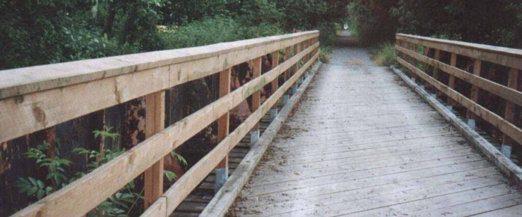
- East Central (river and prairie): This 26.1-mile-long section connects Blyn to Port Angeles, featuring nine bridges and a gentle climb through a prairie region. West of Sequim, the trail passes through Railroad Bridge Park and crosses the Dungeness River floodplain on a large restored railroad bridge and a tall trestle that provides beautiful views of the riverbed.
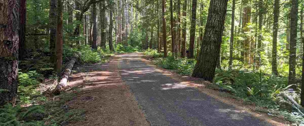
- West Central (foothills and lakes): This section is 31.7 miles and connects Port Angeles to Highway 101 at the top of Fairholm Hill. It crosses the Elwha River on a spectacular suspended bridge and then continues on to parallel the Strait of Juan de Fuca coastline. After curving around Lake Crescent, the trail climbs into a heavily forested plateau that continues into the next part of the trail.
- West (forest and ocean): This section offers 41.6 miles of scenic cycling. Many different rivers run from the Olympics to the sea through this area, and most of the western half of this trail section runs along paved two-lane roads.
To access the Olympic Discovery Trail, visit the official website for detailed directions.
Tips: No matter which section of this trail you ride, bring a camera because there are tons of amazing sights to see along the way! From animals and snow-capped mountains to seals, otters, U.S. Navy vessels, lighthouses, and much more, this is an incredible trail in an exciting area of Washington.
Interested in another state?
Discover the best US places to ride a bike:
- Alabama
- Arizona
- Arkansas
- California
- Colorado
- Connecticut
- Florida
- Georgia
- Hawaii
- Idaho
- Illinois
- Iowa
- Indiana
- Kansas
- Kentucky
- Louisiana
- Maryland
- Massachusetts
- Michigan
- Minnesota
- Missouri
- Mississippi
- Nebraska
- Nevada
- New Jersey
- New Mexico
- New York
- North Carolina
- Ohio
- Oklahoma
- Oregon
- Pennsylvania
- Rhode Island
- South Carolina
- Tennessee
- Texas
- Utah
- Virginia
- Washington
- West Virginia
- Wisconsin
Tired of hypercompetitive fitness apps?
Enjoy Vingo’s judgment-free community!![]() Explore new worlds on many different terrains
Explore new worlds on many different terrains![]() Personalize your avatar with cool clothes and gears
Personalize your avatar with cool clothes and gears![]() Experience Vingo anywhere on any exercise bike or treadmill
Experience Vingo anywhere on any exercise bike or treadmill
References:
- https://www.traillink.com/trail/apple-capital-recreation-loop-trail/
- https://www.wta.org/go-hiking/hikes/apple-capital-recreation-loop-trail
- https://www.traillink.com/trail/burke-gilman-trail/
- https://www.traillink.com/trail/willapa-hills-state-park-trail-/
- https://www.nps.gov/mora/planyourvisit/bicycling.htm
- https://www.wmbcmtb.org/galbraith
- https://cob.org/services/recreation/parks-trails/parks-guide/galbraith-mountain
- https://www.wta.org/go-hiking/hikes/chehalis-western-trail
- https://www.traillink.com/trail/chehalis-western-trail/
- https://pjammcycling.com/climb/246.Mt.%2520Spokane;mode=Summary
- https://rootsrated.com/seattle-wa/cycling/mercer-island-loop
- https://www.wta.org/go-hiking/hikes/cascade-trail
- https://www.traillink.com/trail/cascade-trail/
Photo Sources:
Thayne Tuason, CC BY-SA 4.0 https://creativecommons.org/licenses/by-sa/4.0, via Wikimedia Commons
Visitor7, CC BY-SA 3.0 https://creativecommons.org/licenses/by-sa/3.0, via Wikimedia Commons
Shortiefourten, CC BY-SA 4.0 Shortiefourten, CC BY-SA 4.0 Shortiefourten, CC BY-SA 4.0
Theo Crazzolara, CC BY 2.0 https://creativecommons.org/licenses/by/2.0, via Wikimedia Commons
Emergency Brake, CC BY 2.0 https://creativecommons.org/licenses/by/2.0, via Wikimedia Commons
Robert Ashworth from Bellingham, WA., USA, CC BY 2.0 https://creativecommons.org/licenses/by/2.0, via Wikimedia Commons
SunsetBayNewman, CC BY-SA 4.0 https://creativecommons.org/licenses/by-sa/4.0, via Wikimedia Commons
Robert Ashworth from Bellingham, WA., USA, CC BY 2.0 https://creativecommons.org/licenses/by/2.0, via Wikimedia Commons
Robert Ashworth from Bellingham, WA., USA, CC BY 2.0 https://creativecommons.org/licenses/by/2.0, via Wikimedia Commons
Robert Ashworth, CC BY 2.0 https://creativecommons.org/licenses/by/2.0, via Wikimedia Commons