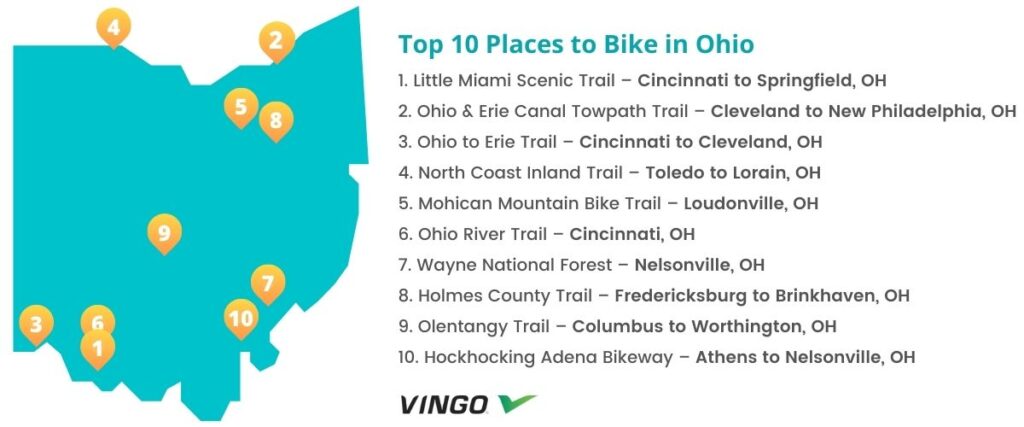
Top 10 Bike Trails In Ohio
- 1. Little Miami Scenic Trail – Cincinnati to Springfield, OH
- 2. Ohio & Erie Canal Towpath Trail – Cleveland to New Philadelphia, OH
- 3. Ohio to Erie Trail – Cincinnati to Cleveland, OH
- 4. North Coast Inland Trail – Toledo to Lorain, OH
- 5. Mohican Mountain Bike Trail – Loudonville, OH
- 6. Ohio River Trail – Cincinnati, OH
- 7. Wayne National Forest – Nelsonville, OH
- 8. Holmes County Trail – Fredericksburg to Brinkhaven, OH
- 9. Olentangy Trail – Columbus to Worthington, OH
- 10. Hockhocking Adena Bikeway – Athens to Nelsonville, OH
- Interested in another state?
Ohio is home to the city of Xenia, the “Bicycle Capital of the Midwest,” and it offers plenty of fantastic trails and bike routes all around the state, just waiting to be explored! If you’re ready to take on a new cycling adventure in Ohio, check out these top ten trails that bikers highly recommend.
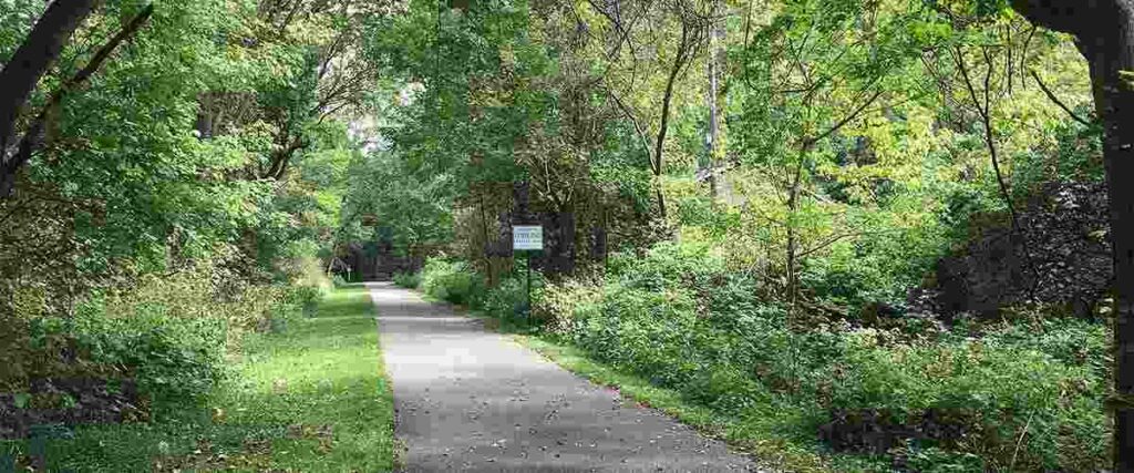
1. Little Miami Scenic Trail – Cincinnati to Springfield, OH
The Little Miami Scenic Trail is one of Ohio’s most popular biking routes. Spanning about 78 miles between Cincinnati and Springfield, this trail passes through gorgeous state parks, over historic bridges, and offers access to several other popular biking and hiking trails.
This bike route is one of America’s many scenic rail-trails, built along the old Little Miami Railroad (LMRR). In addition to offering exciting close-up views of the natural wildlife in Ohio, the Little Miami Scenic Trail also passes through several quaint towns, including Yellow Springs, Loveland, and Milford, which all offer local restaurants, breweries, parks, outdoor recreation, and more. There are also several drinking fountains and restrooms along the route for the convenience of cyclists, joggers, and walkers.
You can park at the southern end of the trail in Clear Creek Park (6200 Batavia Pike) or Newton’s Little Miami Golf Center (3811 Newtown Rd.) At the northern end of the trail, you can park at the Heritage Center in Springfield (117 S. Fountain Avenue).
Tips: This is one of Ohio’s most popular trails, so it can get very busy! Once you get to the Yellow Springs area, consider stopping at the beautiful Glen Helen Nature Preserve, home to the famous Yellow Spring.
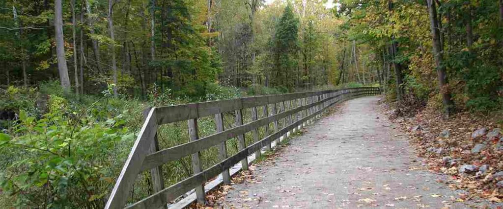
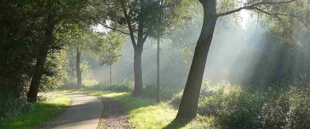
2. Ohio & Erie Canal Towpath Trail – Cleveland to New Philadelphia, OH
The Ohio & Erie Canal Towpath Trail (also sometimes just called the Towpath Trail) is a gorgeous 78-mile trail that runs through the Ohio & Erie Canalway. It’s a significant component of Ohio to Erie trail, which links the Ohio River to Lake Erie. A work in progress, the Towpath Trail will eventually stretch 101 miles from Cleveland to New Philadelphia, following the historic path where mules pulled boats filled with passengers and cargo up and down the canal.
The readers of Ohio Magazine voted this the “Best of Ohio” Bike Trail, and it’s easy to see why. If you start in Cleveland and ride out of the city, the trail will lead you out of an industrial area into Cuyahoga Valley National Park, where the scenery is breathtaking. You’re also bound to see lots of wildlife activity in this area, so plan to make plenty of stops! The trail’s surface varies from asphalt and hard-packed crushed limestone to a boardwalk bridge crossing over the scenic Summit Lake. Overall, it’s an easy and enjoyable ride for cyclists of all abilities.
There are more than 50 different trailheads with parking along the Ohio & Erie Canal Towpath Trail. The easiest way to plan your ride is to visit the Ohio & Erie Canalway website and check out their map of all the trailheads.
Tips: The grade of the Towpath Trail is very gentle overall. However, the route does include two suspension bridges, which rise to 30 feet above the roadway and have a 7% grade. There are also no trailside services between Navarre and Bolivar, so plan accordingly.
3. Ohio to Erie Trail – Cincinnati to Cleveland, OH
The Ohio to Erie Trail (OTET) is the longest biking trail in Ohio, spanning 330 miles from Cincinnati to Cleveland. This route is popular with avid cyclists and stretches through four major cities and several exciting attractions, offering serene and beautiful countryside views.
Whether you bike a portion of the trail for a day or you embark on a multi-day trip across the state, Ohio to Erie Trail is quite the adventure. The route is primarily off-road and winds through recreational areas formerly occupied by railroads and canals. It’s known as Route 1 in Ohio and is very well-marked, passing through many small and large towns, rural farmland, nature preserves, Amish heritage areas, museums, and regional parks.
The OTET website is the best resource if you’re trying to plan your ride and locate trailhead parking and access points.
Tips: Some trail areas have alternative routes for north and southbound cyclists. The signs along these routes all have an “ALT” sticker in the top section to indicate another way to continue riding the OTET.
4. North Coast Inland Trail – Toledo to Lorain, OH

The North Coast Inland Trail is a converted railroad track system, originally the Penn Central Railroad. It will be 105 miles long, running from Toledo to Lorain when complete. This trail features scenic over-street bridges, frequently-changing scenery, and convenient bike fix-it stations and picnic shelters where cyclists can rest and repair their bikes if needed.
Although it’s still a work in progress, it offers a fantastic ride through several charming towns, pure rural Ohio countryside, and historic landmarks, including Oberlin’s old train depot building. The most popular segment of this trail stretches 28 miles from Bellevue to Elmore, and there are plenty of access points where cyclists can hop on the path.
There are many different parking areas and access points along the North Coast Inland Trail route, so it’s best to determine where you want to start your ride and then visit the county park district’s website to find convenient access points.
Tips: Some of the sections of this trail are less bike-friendly than others, so always be aware of your surroundings and traverse bike crossings with care.
5. Mohican Mountain Bike Trail – Loudonville, OH
Mohican State Park’s mountain bike trail is Ohio’s longest singletrack open to bikes and an IMBA EPIC, meaning it’s totally worth a trip out there! Voted the #1 mountain bike trail in the state by Mountain Bike Action Magazine and deemed a “must ride” by National Geographic Explorer Magazine, this is one of Ohio’s best mountain biking spots. With about 25 miles of singletrack and an elevation gain of nearly 1,655 feet, this trail is one incredible workout.
The Mohican State Park Mountain Bike Trail features challenging climbs, fast and flowy downhill sections, switchbacks, and bumpy rock gardens that will keep your blood pumping. This thrilling ride is not for beginners, and it will test your abilities, but it’s a great ride that will continually challenge and enthrall cyclists looking for some excitement.
This trail is located in Mohican State Park, outside Loudonville, Ohio, off route 3. The address is 3116 OH-3, Loudonville, OH 44842.
Tips: This trail is fun but challenging, so if you think you might need to bail before completing the entire 25-mile ride, you should check out a map and take note of all the bailout points because they’re limited. The campground office has a great map for cyclists new to the area. It costs a few dollars to purchase it.
6. Ohio River Trail – Cincinnati, OH
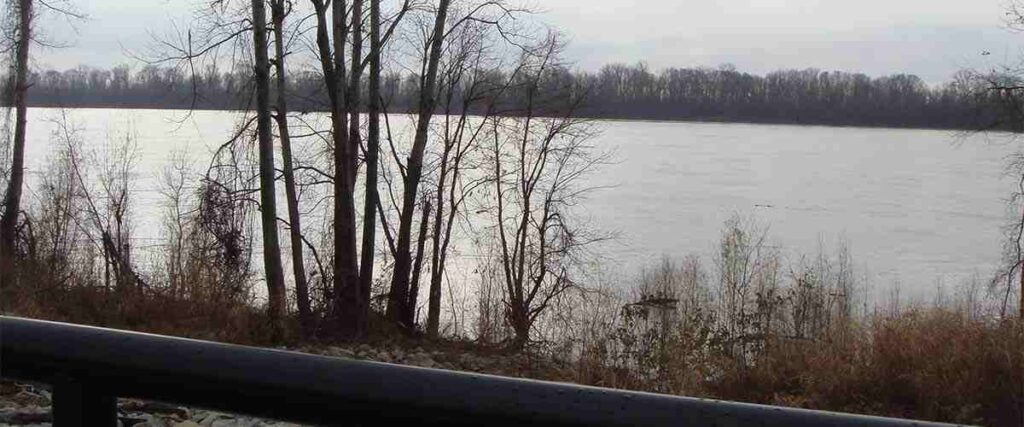
The scenic Ohio River Trail is a paved path that runs along the Ohio River and offers excellent views of downtown Cincinnati, which is not far off. For cyclists looking for a scenic and relaxing ride near the city, this one is great!
This trail is about 5 miles long, with an elevation gain of about 62 feet. It’s paved the entire way, and its 3% grade provides a gentle and enjoyable ride for cyclists of all ages and skill levels. In addition to biking, the Ohio River Trail is also a popular spot for running, walking, and bird watching. You can even bring your dog along with you for the ride, but you’ll need to keep it on a leash at all times.
Before you begin this ride, you can park in the free paved lot off East Pete Rose Way, about 1.2 miles along the trail. There is another lot at the beginning of the trail, across from Paul Brown Stadium, but it’s pay to park, so bring cash or your card.
Tips: There are plenty of great photo ops along this trail, so if you’re into photography, make sure to bring your camera! And of course, consider making time to check out Cincinnati’s top attractions while you’re in the area, such as the Cincinnati Zoo & Botanical Garden, the Cincinnati Art Museum, and the beautiful Eden Park downtown.
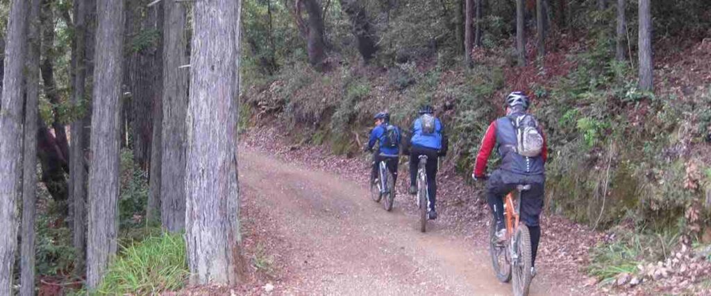
7. Wayne National Forest – Nelsonville, OH

The Wayne National Forest is home to 142 miles of singletrack trails for mountain bikers, including the popular Wayne National Forest Epic trail, which is a 35-mile loop that’s known for its length, scenic rock outcroppings, and incredible 7-mile descent near the end.
While the Wayne National Forest Epic is ideal for advanced and adventurous cyclists, the national forest offers many other trail systems that range in difficulty. The Baileys Trail System in the Athens Ranger District is another highly-recommended spot in the Wayne National Forest, with 26 miles of thrilling and scenic mountain biking trails to explore.
The Wayne National Forest Welcome Center is at 13700 US Highway 33
Nelsonville, OH 45764. To get to the Wayne National Forest Epic trail, park at the Ohio View Trail trailhead on the edge of Highway 7. To access the Baileys Trail System, park at Chauncey-Dover Community Park in Chauncey, OH.
Tips: This is a wild place to bike, so come prepared! Bring lots of water, lunch, a first aid kit, and essential trail tools for repairs. Also, be aware that the trails at Wayne National Forest are also closed to biking, off-highway vehicles, and horses from December 16 to April 14.
8. Holmes County Trail – Fredericksburg to Brinkhaven, OH
Holmes County Trail is a 22-mile paved and gravel trail and was the first one in the United States to accommodate Amish buggies. One side of this trail is paved with asphalt for cyclists, runners, and walkers, while the other side is paved with chip seals for horse-drawn buggies and equestrians. Once complete, the entire trail will span 29 miles.
A scenic and unique route through Ohio’s Amish Country, the Holmes County Trail has a very gentle grade and offers gorgeous rural scenery, featuring stunning wildflowers in the Spring, serene creek crossings, and plenty of wildlife sightings along the way. There is even a railroad museum and bike shop along the route in Millersburg and several local restaurants and attractions to check out in Fredericksburg, Holmesville, and Killbuck.
For details on where to park and how to access the trail from various parts of the route, visit the Holmes County Trail website.
Tips: This is a very kid-friendly and family-friendly ride, so bring the whole gang! There are even several benches along the route if you need to stop and rest or take a break for a snack.
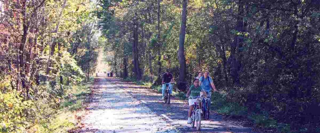
9. Olentangy Trail – Columbus to Worthington, OH
The Olentangy Trail begins just west of downtown Columbus and follows the Olentangy River until it ends in Worthington Hills Park in Worthington, Ohio. The paved trail is about 22 miles in its entirety and is a fun way for cyclists to explore the Columbus area, including Ohio State University.
Not surprisingly, the Olentangy Trail is a popular route for bikers because it is well-maintained and meanders through some beautiful, scenic natural areas. However, it also offers more diverse scenery as it passes through the bustling heart of Ohio State University. You’ll also enjoy other significant sites and recreation areas along the trail, like the Park of Roses, the Wilma H. Schiermeier Olentangy River Wetland Research Park, and Antrim Park. The Olentangy Trail even winds through some of the area’s historic neighborhoods, including the Clintonville and Harrison West communities.
There are no designated parking lots on the south side of the trail, but you can access it via many recreational parks along the northern half of the route. Check out the Central Ohio Greenways website for more details.
Tips: Since this trail traverses through a busy college campus, it can get pretty crowded. Some cyclists say it’s best to dismount your bike and walk this section.
10. Hockhocking Adena Bikeway – Athens to Nelsonville, OH
The Hockhocking Adena Bikeway runs about 20 miles along an old railroad bed, mostly following the Hocking River. It also connects Ohio University in Athens and Hocking College in Nelsonville, passing through the gorgeous Wayne National Forest along the way, which is home to more than 300 miles of trails and endless scenic vistas.
This paved, flat, and easy ride is ideal for riders of all ages and experience levels. It’s an enjoyable ride through peaceful lush and dense forest, and every so often, you’ll catch a peek of beautiful farmland or scenic rock outcroppings through the openings in the trees. Adventurers on this trail also pass by several points of interest, including Bluebell Nature Preserve, the Floodwood mine rail trestle, and Hocking Valley Scenic Railway.
For details on parking and trail access, take a look at this map provided by the Bike Athens Ohio website and the Athens County Convention and Visitors Bureau.
Tips: You can rent a bike at several locations along the route, including the Athens, Nelsonville, and Plains library branches. Popular side trips from this trail include visits to Richland Avenue Park, the Dairy Barn Arts Center, the Ridges Kennedy Museum of Art, and uptown Athens.
Interested in another state?
Discover the best US places to ride a bike:
- Alabama
- Arizona
- Arkansas
- California
- Colorado
- Connecticut
- Florida
- Georgia
- Hawaii
- Idaho
- Illinois
- Iowa
- Indiana
- Kansas
- Kentucky
- Louisiana
- Maryland
- Massachusetts
- Michigan
- Minnesota
- Missouri
- Mississippi
- Nebraska
- Nevada
- New Jersey
- New Mexico
- New York
- North Carolina
- Ohio
- Oklahoma
- Oregon
- Pennsylvania
- Rhode Island
- South Carolina
- Tennessee
- Texas
- Utah
- Virginia
- Washington
- West Virginia
- Wisconsin
References:
- https://www.traillink.com/trail/little-miami-scenic-trail/
- https://www.ohioanderiecanalway.com/explore/the-towpath-trail/
- https://www.traillink.com/trail/ohio–erie-canal-towpath-trail/
- https://www.ohiotoerietrail.org
- https://www.loraincountymetroparks.com/north-coast-inland-trail
- https://www.lovemyparks.com/parks/north-coast-inland-trail
- https://www.traillink.com/trail/north-coast-inland-trail-(sandusky-and-ottawa-counties)/
- https://www.mtbproject.com/trail/960984/mohican-mountain-bike-trail-imba-epic
- https://www.alltrails.com/trail/us/ohio/ohio-river-trail
- https://www.fs.usda.gov/recarea/wayne/recreation/bicycling/recarea/?recid=83160&actid=24
- https://www.fs.usda.gov/activity/wayne/recreation/bicycling/?recid=6203&actid=24
- https://www.holmestrail.com
- https://www.alltrails.com/trail/us/ohio/holmes-county-trail
- https://www.traillink.com/trail/olentangy-trail/
- https://www.bikeathensohio.com/the-bikeway
Photo Sources:
LittleT889, CC BY-SA 4.0 https://creativecommons.org/licenses/by-sa/4.0, via Wikimedia Commons
Kevin Payravi, CC BY-SA 3.0 https://creativecommons.org/licenses/by-sa/3.0, via Wikimedia Commons
Kevin Payravi, CC BY-SA 3.0 https://creativecommons.org/licenses/by-sa/3.0, via Wikimedia Commons
Nyttend, Public domain, via Wikimedia Commons
Wordcraft, CC BY-SA 3.0 https://creativecommons.org/licenses/by-sa/3.0, via Wikimedia Commons
Ravenonhealth, CC BY-SA 3.0 https://creativecommons.org/licenses/by-sa/3.0, via Wikimedia Commons
Wayne National Forest, CC BY 2.0 https://creativecommons.org/licenses/by/2.0, via Wikimedia Commons
National Archives and Records Administration, Public domain, via Wikimedia Commons
Minh Nguyen, CC BY-SA 4.0 https://creativecommons.org/licenses/by-sa/4.0, via Wikimedia Commons
Bios, CC BY-SA 3.0 http://creativecommons.org/licenses/by-sa/3.0/, via Wikimedia Commons