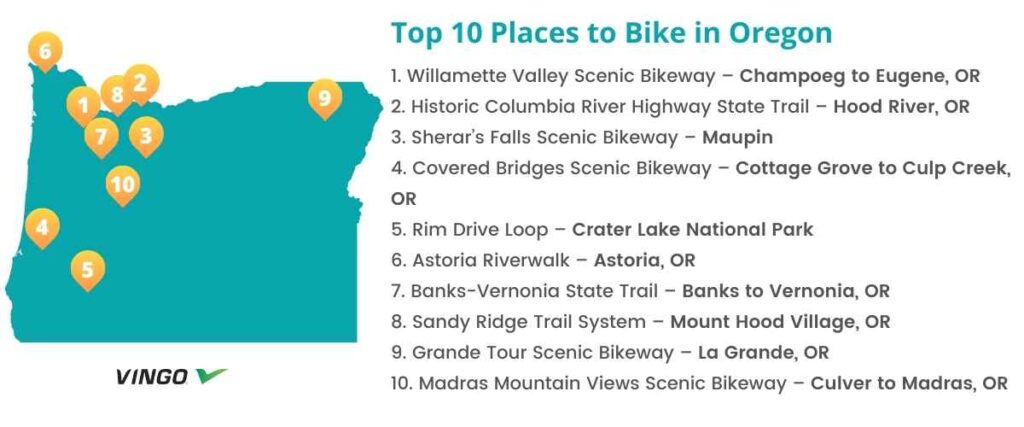
Top 10 Bike Trails in Oregon
- 1. Willamette Valley Scenic Bikeway – Champoeg to Eugene, OR
- 2. Historic Columbia River Highway State Trail – Hood River, OR
- 3. Sherar’s Falls Scenic Bikeway – Maupin
- 4. Covered Bridges Scenic Bikeway – Cottage Grove to Culp Creek, OR
- 5. Rim Drive Loop – Crater Lake National Park
- 6. Astoria Riverwalk – Astoria, OR
- 7. Banks-Vernonia State Trail – Banks to Vernonia, OR
- 8. Sandy Ridge Trail System – Mount Hood Village, OR
- 9. Grande Tour Scenic Bikeway – La Grande, OR
- 10. Madras Mountain Views Scenic Bikeway – Culver to Madras, OR
- Interested in another state?
From scenic bikeways to rail trails and more, Oregon is one of the best states for cycling. For some of the best biking routes in the state, check out our top 10 list of Oregon trails to explore on two wheels.
1. Willamette Valley Scenic Bikeway – Champoeg to Eugene, OR
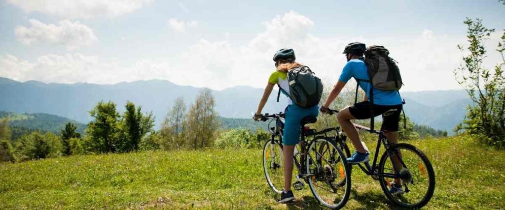
The Willamette Valley Scenic Bikeway is Oregon’s first Scenic Bikeway and a favorite among cyclists countrywide. Start your ride at Champoeg State Heritage Area along the Willamette River. The mostly flat route continues for 134 miles through a stunning agricultural valley with beautiful views and several historic landmarks along the way. The valley is known for its pinot noir wine, hazelnuts, hops, and marionberries, and you can enjoy the journey any time of the year. As you bike, you’ll pass through the small towns of Salem, Albany, Brownsville, Independence, and Coburg. The route ends at Armitage County Park, just north of Eugene.
Tips: Champoeg State Heritage Area offers year-round camping if you plan to make your ride into a multi-day trip. The park offers an 18-hole disc golf course, fishing and kayaking on the river, pet-friendly camping areas, toilets, and hot showers. Armitage County Park, at the trail’s southern terminus, also offers several amenities and camping.
2. Historic Columbia River Highway State Trail – Hood River, OR
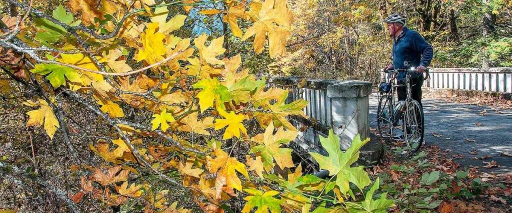
The Historic Columbia River Highway State Trail was once the main driving route across the top of Oregon. Today, it’s a bike-only path that follows the Columbia River Gorge for a scenic and exciting adventure through some of Oregon’s beautiful desert and dense forests. The trail is made up of three separate paved pathways along Highway 30. Together, the three segments include more than 12 miles of bikeway through the beautiful scenery of North Oregon, past several waterfalls, the Summit Creek Viaduct, Mosier Twin Tunnels, and more.
Tips: Dogs are allowed on the Historic Columbia River Highway State Trail but must be on a leash of six feet or less.
3. Sherar’s Falls Scenic Bikeway – Maupin
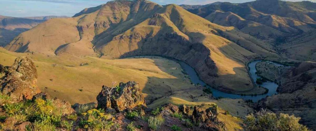
Sherar’s Falls Scenic Bikeway is a 33-mile loop that features the beautiful landscape around the Lower Deschutes River. With gorgeous water views, the high desert terrain, and endless flowing fields of wheat, this bikeway is worth a tour any time of year. Start your ride in Maupin and climb up the high land between the Deschutes and White rivers before you drop down into Tygh Valley. Next, you’ll pass by White River Falls State Park before cycling down into the Deschutes riverbed. Finally, you’ll follow the river through the canyon until you reach Sherar’s Falls, a historic fishing area for Native Americans.
Tips: White River Falls State Park is an excellent side trip, if you have the time. The falls are fully flowing in the spring, but in autumn, they slow down significantly.
4. Covered Bridges Scenic Bikeway – Cottage Grove to Culp Creek, OR
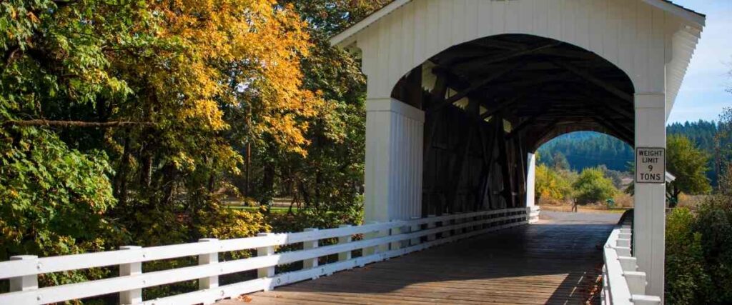
The Covered Bridges Scenic Bikeway is a 35-mile loop that encompasses a trip through the Cottage Grove Downtown Historic Commercial District (a gold mining hub in the 1860s) and the 17-mile Row River Trail. As its name suggests, this route has many historic covered bridges to enjoy as you cycle southeast of Cottage Grove and into the quiet countryside. The trail is built along an old railroad, so it’s mostly flat, and the gentle slope of the path is perfect for cyclists of all experience levels.
Tips: Pace yourself however you’d like on the Covered Bridges Scenic Bikeway. There are plenty of nearby amenities, including bathrooms, seven parking areas, and three picnic areas where you can easily stop to refuel and rest.
5. Rim Drive Loop – Crater Lake National Park
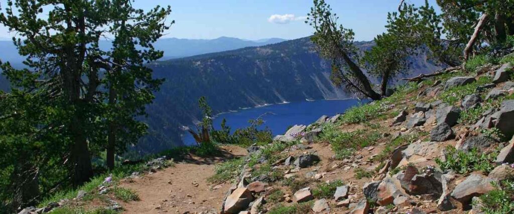
The Rim Drive Loop at Crater Lake National Park boasts 33 beautiful miles of volcanic crater views. Formed by a violent volcanic eruption thousands of years ago that set off the collapse of a tall mountain peak, Crater Lake is fed by rain and snow and is the deepest lake in the United States. As you cycle around the rim of the enormous lake, you’ll be 7,000 feet above sea level and have 30 scenic overlooks to enjoy along the way. However, this biking route is not for the faint of heart. You’ll tackle some challenging hills, so make sure you’re physically ready for the adventure before you head out!
Tips: Crater Lake National Park is very remote, so make sure you have a map and know where you’re going. You’ll also share Rim Drive Loop with vehicular traffic, so watch carefully for cars and be forewarned that the winding, narrow road does not have shoulders.
6. Astoria Riverwalk – Astoria, OR
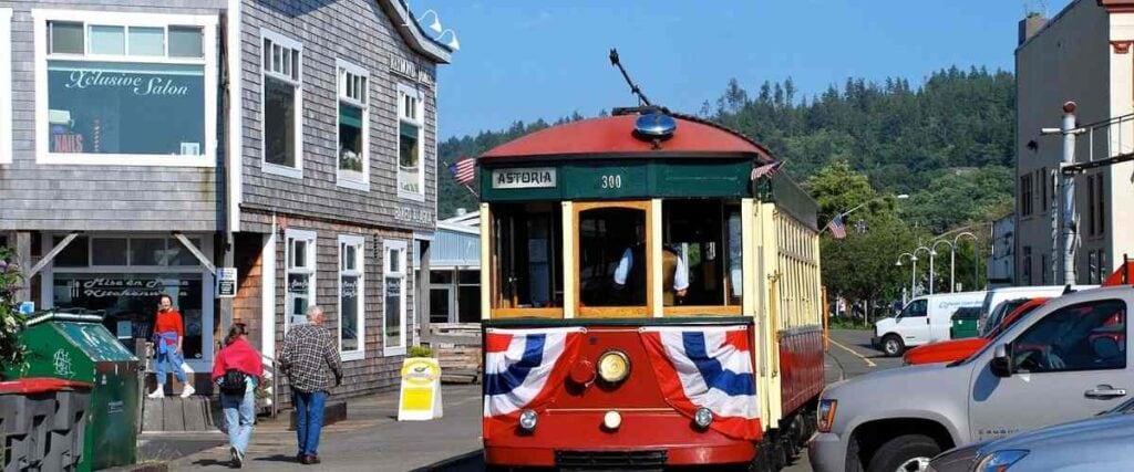
For fans of the 1985 movie “The Goonies,” the town of Astoria may have a special significance, but the Astoria Riverwalk is also an excellent place to cycle! This 6.4-mile trail is a fun way to tour the coastal city and offers fantastic views of the Columbia River and all its natural beauty and wildlife. The route follows a portion of the Astoria & Columbia River Railroad and provides plenty of opportunities to get in touch with Astoria’s fascinating history. For example, near the trail’s end, you’ll discover Tongue Point, where the men of the Lewis & Clark Expedition camped in March of 1806.
Tips: We also highly recommend checking out local attractions near the Astoria Riverwalk, including the Columbia River Maritime Museum, the restored Astoria Trolley tour, several shipwrecks, and many of the restaurants, shops, and breweries in town.
7. Banks-Vernonia State Trail – Banks to Vernonia, OR
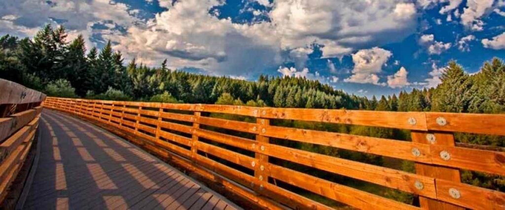
True to its name, the Banks-Vernonia State Trail passes through the hilly landscape between the communities of Banks and Vernonia. It spans about 23 miles along a former railroad, featuring 13 bridges and two massive railroad trestles that offer incredible views of the forested hills and bubbling creeks. Most of the route is an 8-foot path that traverses a gentle grade, except for one area at Horseshoe Trestle Bypass, which features switchbacks up 700 feet and a descent of 300 feet. About halfway along the trail, you’ll pass through L. L. Stub Stewart State Park and campground before continuing on into Vernonia, where the trail ends at Mill Pond/Vernonia Lake.
Tips: In Vernonia, you’ll find cute shops, galleries, and a museum if you decide to stop there and explore before heading back the way you came.
8. Sandy Ridge Trail System – Mount Hood Village, OR
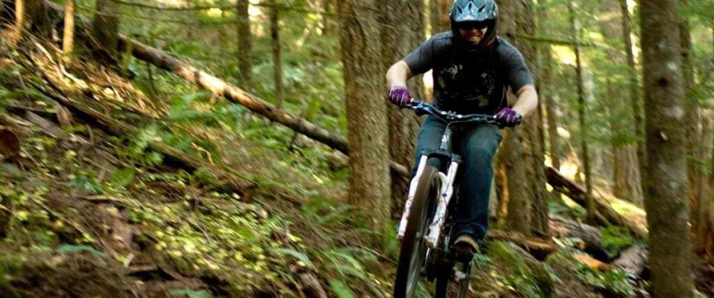
The Sandy Ridge Trail System east of Portland is touted as being one of the most cutting-edge mountain biking trail systems on public land. The system features 17 miles of fantastic trails catering to cyclists who want more advanced, technical singletrack. The trails are managed by the Bureau of Land Management (BLM), and were designed and built by Trail Solutions, with help from AntFarm and the Northwest Trail Alliance, an IMBA chapter. Not surprisingly, it’s a very well-maintained system! Cyclists from all over the country travel to the Sandy Ridge Trail System to experience its many features, with options for cyclists of all abilities.
Tips: While the routes at Sandy Ridge Trail System lean more advanced, there are options for beginner cyclists too.
9. Grande Tour Scenic Bikeway – La Grande, OR
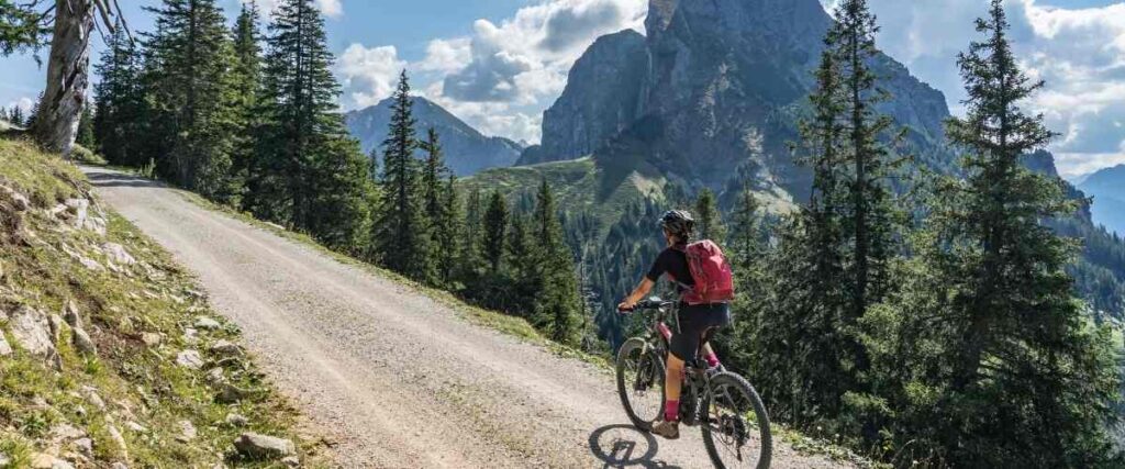
The 134-mile Grande Tour Scenic Bikeway is a challenging ride that rewards the most determined cyclists with gorgeous mountain views that can’t be matched. The route is a figure eight with two connected loops and ample opportunities for fun stops along the way. While you ride, you’ll cycle through Union, North Powder, Baker City, Union, and Cove, where you can enjoy the popular local art galleries, breweries and craft beer, and farms and ranches that offer fresh fruit, honey, goat milking demonstrations, and more.
Tips: If you don’t want to bike the entire route simultaneously, you can ride each loop separately and slow down to enjoy a few pit stops.
10. Madras Mountain Views Scenic Bikeway – Culver to Madras, OR

The Madras Mountain Views Scenic Bikeway is a moderately challenging 29-mile loop through central Oregon. It features impressive views of the area’s volcanoes and agricultural areas as you pass through the towns of Culver, Metolius, and Madras. Along the way, you’ll also catch sight of several mountainous peaks, including Mt. Hood, Mt. Jefferson, and the Three Sisters. The bikeway provides a smooth, paved road from which you can soak up the scenery and encounter the local wildlife.
Tips: In Madras, you’ll find plenty of lodging options to extend your stay in the area.
Interested in another state?
Discover the best US places to ride a bike:
- Alabama
- Arizona
- Arkansas
- California
- Colorado
- Connecticut
- Florida
- Georgia
- Hawaii
- Idaho
- Illinois
- Iowa
- Indiana
- Kansas
- Kentucky
- Louisiana
- Maryland
- Massachusetts
- Michigan
- Minnesota
- Missouri
- Mississippi
- Nebraska
- Nevada
- New Jersey
- New Mexico
- New York
- North Carolina
- Ohio
- Oklahoma
- Oregon
- Pennsylvania
- Rhode Island
- South Carolina
- Tennessee
- Texas
- Utah
- Virginia
- Washington
- West Virginia
- Wisconsin
Sources:
- https://traveloregon.com/wp-content/uploads/2019/11/SB-WV-Maps-and-Cues.pdf
- https://traveloregon.com/things-to-do/outdoor-recreation/bicycling/willamette-valley-scenic-bikeway/
- https://stateparks.oregon.gov/index.cfm?do=park.profile&parkId=113
- https://traveloregon.com/things-to-do/outdoor-recreation/bicycling/road-biking/sherars-falls-scenic-bikeway/
- https://traveloregon.com/things-to-do/outdoor-recreation/bicycling/road-biking/covered-bridges-scenic-bikeway/
- https://traveloregon.com/wp-content/uploads/2019/11/SB-Covered-Bridges-Map-and-Cue.pdf
- https://www.nps.gov/crla/planyourvisit/scenic-rim-drive.htm
- https://www.nps.gov/crla/index.htm
- https://www.nps.gov/places/astoria-riverwalk.htm
- http://www.astoriaoregon.com
- https://www.traillink.com/trail/astoria-riverwalk/
- https://www.traillink.com/trail/banks-vernonia-state-trail/
- https://www.imba.com/project/sandy-ridge-trail-system
- https://www.mtbproject.com/trail/3482113/sandy-ridge-trail-system-full-tour?
- https://www.blm.gov/or/resources/recreation/files/brochures/sdo_sandyridge_map2013_508.pdf
- https://traveloregon.com/things-to-do/outdoor-recreation/bicycling/road-biking/grande-tour-scenic-bikeway/
- https://traveloregon.com/things-to-do/outdoor-recreation/bicycling/road-biking/madras-mountain-views-scenic-bikeway/
Photo Sources:
- Oregon Department of Transportation, CC BY 2.0, via Wikimedia Commons
- Bureau of Land Management Oregon and Washington from Portland, America, Public domain, via Wikimedia Commons
- Markgorzynski, CC BY-SA 3.0, via Wikimedia Commons
- Steve Morgan, CC BY-SA 3.0, via Wikimedia Commons
- B J IMAGERY from Beaverton, CC BY-SA 2.0, via Wikimedia Commons
- Bureau of Land Management, Public domain, via Wikimedia Commons


