
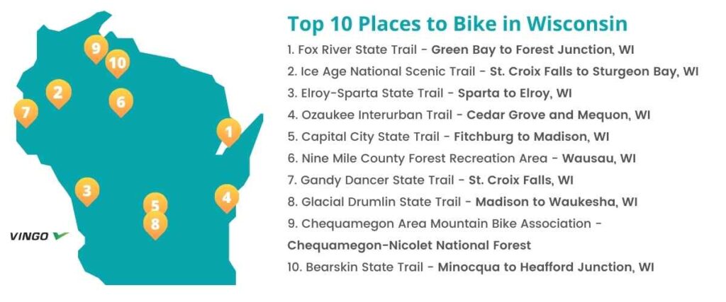
Top 10 Bike Trails in Wisconsin
- 1. Fox River State Trail – Green Bay to Forest Junction, WI
- 2. Ice Age National Scenic Trail – St. Croix Falls to Sturgeon Bay, WI
- 3. Elroy-Sparta State Trail – Sparta to Elroy, WI
- 4. Ozaukee Interurban Trail – Cedar Grove and Mequon, WI
- 5. Capital City State Trail – Fitchburg to Madison, WI
- 6. Nine Mile County Forest Recreation Area – Wausau, WI
- 7. Gandy Dancer State Trail – St. Croix Falls, WI
- 8. Glacial Drumlin State Trail – Madison to Waukesha, WI
- 9. Chequamegon Area Mountain Bike Association – Chequamegon-Nicolet National Forest
- 10. Bearskin State Trail – Minocqua to Heafford Junction, WI
- Interested in another state?
Not surprisingly, Wisconsin is home to stunning glacial landscapes, ancient forests, and fun urban areas to explore on two wheels. Whether you’re a resident or you’re just visiting the area, here are 10 of the most highly-rated trails for cyclists in Wisconsin.
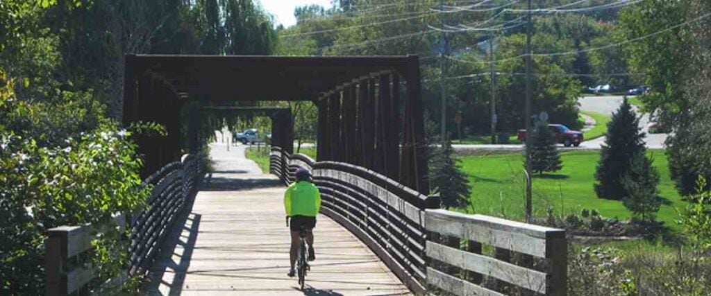
1. Fox River State Trail – Green Bay to Forest Junction, WI
The Fox River State Trail spans 25 miles from Green Bay to the farm communities south of the city. It follows the Fox River for about five miles before it branches off into the Wisconsin countryside.
Originally used by American Indians and French explorers, this route follows the river south from Green Bay before continuing to an urban area with plenty of attractions and restaurants. Shortly after you leave the burbs, the trail becomes crushed stone, and you’ll pass through the small town of Greenleaf. In 7.5 miles, you’ll reach Forest Junction and pass a connection to the Friendship State Trail, which you can ride 4 miles to Brillion. The first 11 miles of this ride feature beautiful parks, gardens, and river views, while the second half offers a glimpse into the area’s fertile farmland.
Trailheads and parking are available in Green Bay, Greenleaf, and Forest Junction.
Tips: Bicyclists on the Fox River State Trail must buy a state trail pass to bike this route. It costs $5 per day or $25 for residents and non-residents.
2. Ice Age National Scenic Trail – St. Croix Falls to Sturgeon Bay, WI
The Ice Age National Scenic Trail is one of 11 National Scenic Trails and provides a tour of some of Wisconsin’s most incredible landscapes. With 1,200 scenic miles of trail to explore, this route is one of the most widely visited in the state.
As you bike this trail, you’ll ride through a gorgeous landscape carved out of the earth by a glacier more than 12,000 years ago. The route begins in Potawatomi State Park and encompasses a healthy mix of off-road, forested sections, and segments that take you right through the center of heavily populated Wisconsin communities. Connecting state parks, city parks, national forests, and private land in 30 different counties, you’ll see a little bit of everything on the Ice Age National Scenic Trail!
Since this trail is so long, it may be best to pick either the Western, Central or Eastern segment and plan your route from there. You can learn more about each of the trail segments here.
Tips: The Ice Age National Scenic Trail also connects with many rail trails and state trails along the route.
3. Elroy-Sparta State Trail – Sparta to Elroy, WI
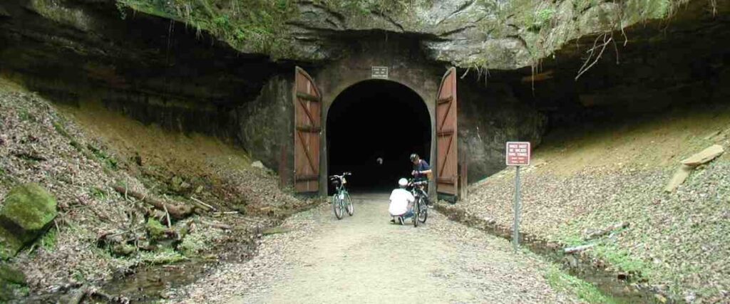
The Elroy-Sparta State Trail is one of the most popular trails in the state, spanning 32.5 miles between Sparta and Elroy. When it opened in 1967, it was one of the earliest rail-trail projects in the U.S. Today, it’s still a well-loved route among cyclists, runners, and walkers.
You’ll pass through five small Wisconsin towns and three famous and spectacular rock tunnels as you bike this trail. You’ll also enjoy views of wetlands, prairies, farmland, and unglaciated areas. There’s also easy access to bathrooms, water, and camping areas all along the route. Although a state trail pass is required to explore this path by bike, it’s well worth the fee, which goes toward maintaining the route.
There are trailheads with parking in Sparta and Elroy, making it easy to park and hop right on the bike path.
Tips: The Elroy-Sparta State Trail connects to the 400 State Trail, Omaha Trail, and the La Crosse River State Trail.
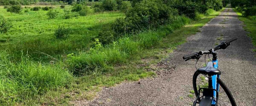
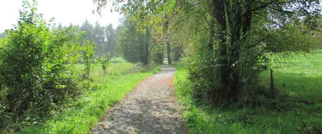
4. Ozaukee Interurban Trail – Cedar Grove and Mequon, WI
The Ozaukee Interurban Trail is a 30-mile paved trail that spans the entirety of Ozaukee County. Great for commuters and recreational cyclists alike, this bike path is perfect for year-round recreation.
This route connects the communities of Mequon, Thiensville, Cedarburg, Grafton, Port Washington, and Belgium, passing through farmland, woodlands, and wetlands along the way. You’ll also bike along the Milwaukee River, Lake Michigan, and the Lake Michigan National Marine Sanctuary, home to 36 historic shipwreck sites! The Ozaukee Interurban Trail also provides access to the county’s various downtown areas, which are fun to explore on a bike or on foot.
There are at least 17 different places to park along this trail. You can find details on the official Ozaukee Interurban Trail website.
Tips: Unlike many other trails in Wisconsin, the Ozaukee Interurban Trail is free for everyone to use. No trail pass is required!
5. Capital City State Trail – Fitchburg to Madison, WI

The Capital City State Trail is a 17-mile asphalt rail-trail that features many highlights and cool sites to explore. By far, it’s one of the best ways to see the city of Madison, Wisconsin!
As you bike from the suburb of Fitchburg, you’ll pass through patches of wooded park areas before passing through the stunning 2,500-acre Capital Springs State Park and Recreation Area. While you’re in the area, stop by the Lussier Family Heritage Center to learn about local Native American culture and pioneer settlements. A little further along the trail, you’ll reach Olin Park, where you can soak in gorgeous views of downtown Madison across Lake Monona. The route continues along the shoreline for a while, passing by the beautifully-designed Monona Terrace Community and Convention Center, meandering through historical Madison neighborhoods, and finally passing the 16-acre Olbrich Botanical Gardens before ending shortly after.
There is trail parking in both Madison and Fitchburg, which makes it convenient to start cycling at either end of the trail.
Tips: The Capital City State Trail also intersects with several other fantastic trails, including the Southwest Commuter Path, which heads to Madison, the Badger State Trail, which goes south to Illinois, and the Cannonball Path, which connects with Military Ridge State Trail. Eventually, it will also connect to the Glacial Drumlin State Trail.
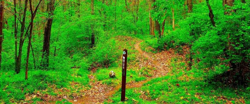
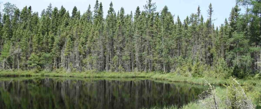
6. Nine Mile County Forest Recreation Area – Wausau, WI
The Nine Mile County Forest Recreation Area is one of the most popular biking and hiking destinations in Northeast Wisconsin. The area hosts several mountain bike races throughout the year, but it’s also just a great place to get out and ride for fun.
This forest area has about 4,900 acres of mixed uplands and marshes, with two streams (Black Creek and Four-Mile Creek) that wind through Nine Mile Swamp. It also features a well-maintained system of trails totaling more than 30 miles, including 10 miles of singletrack mountain biking trails and 20 miles of cross country trails.
The main trailhead starts at the large formal parking area at 221700 Red Bud Road, Wausau, WI 54401.
Tips: Cyclists (ages 12 and up) at Nine Mile County Forest Recreation Area must purchase a daily or annual pass. The trails open as early as May 1 and stay open through October 15 each year.
7. Gandy Dancer State Trail – St. Croix Falls, WI

The Gandy Dancer State Trail is a 98-mile recreational trail that features some truly fantastic sights and even crosses over into Minnesota for part of the ride. The route is divided into two sections: the northern and southern sections.
- The northern section of the Gandy Dancer State Trail begins on the Minnesota side of the St. Croix River. It stretches through Minnesota for 31 miles before crossing over the Wisconsin state line for another 15 miles. While biking this section of the trail, you’ll love cycling over the scenic 520-foot trestle bridge, which stretches over the St. Croix National Scenic Riverway.
- The southern section of the Gandy Dancer State Trail spans 47 miles in Wisconsin. It passes through the communities of Centuria, Milltown, Luck, Frederic, Siren Webster, and Danbury at the border of Minnesota.
Additionally, there are plenty of bike repair stations, campgrounds, lodging options, restaurants, and more along this route. The Ice Age National Scenic Trail also shares a 19-mile section of the Gandy Dancer State Trail, so you can explore two excellent trails in one!
Tips: You’ll need to purchase a state trail pass to cycle on the Gandy Dancer State Trail.
8. Glacial Drumlin State Trail – Madison to Waukesha, WI

The Glacial Drumlin State Trail spans 52 miles between the two largest urban areas in the state: Madison and Milwaukee. Most of the route is on an abandoned rail corridor, except for a 1.5-mile section that uses public roads.
As you bike this trail, you’ll pass through 10 quaint towns. Once you cycle beyond the city, you’ll also enjoy incredible views of glacial topography, scenic farmland, ponds, rivers, marshes, and more. Plus, you’re bound to catch a glimpse of some of the wildlife that calls these various landscapes home.
There are several trailheads along the way, featuring restrooms, parking, and picnic areas where you can stop for a quick snack or lunch break.
Tips: The Glacial Drumlin State Trail also connects with other trails in the Fox River Sanctuary in Waukesha.
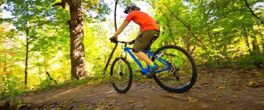
9. Chequamegon Area Mountain Bike Association – Chequamegon-Nicolet National Forest
The Chequamegon Area Mountain Bike Association’s (CAMBA) regional mountain biking trail system is one of Wisconsin’s premier riding destinations. Located in and around the gorgeous Chequamegon-Nicolet National Forest, the area boasts nearly one million acres and more than 300 miles of trails to ride your bike!
This nationally recognized trail system features the Rock Lake Trail, a local favorite and an IMBA Epic ride. However, the area isn’t just for experienced cyclists. It’s for riders of all ages and abilities! There’s something here for everyone, whether you’ve been mountain biking for years or just started.
Visit the USDA Forest Service website for more details on how to get to CAMBA’s mountain bike trail system.
Tips: You’ll need to pay a $5 fee to bike at the Chequamegon-Nicolet National Forest.
10. Bearskin State Trail – Minocqua to Heafford Junction, WI
The Bearskin State Trail is a 21.5-mile trail and a former railroad corridor that follows the Bearskin Creek through the Northwoods of Wisconsin.
Originally, this route was used to transport white pine logs from Northern Wisconsin to the cities in the Midwest. Today, it’s a heavily forested recreational trail enjoyed by cyclists, runners, walkers, and even snowmobilers during the winter months. Along the way, you’ll cross 16 converted railroad trestles and interpretive signs posted along the trail offer a peek back into the area’s history. A peaceful and scenic ride, this trail offers plenty of lake views, century-old white pines, local wildlife, and more to keep you happy as you cycle.
There are trailheads and parking areas in Minocqua and Heafford Junction.
Tips: Cyclists must purchase a state trail pass to bike the Bearskin State Trail.
Interested in another state?
Discover the best US places to ride a bike:
- Alabama
- Arizona
- Arkansas
- California
- Colorado
- Connecticut
- Florida
- Georgia
- Hawaii
- Idaho
- Illinois
- Iowa
- Indiana
- Kansas
- Kentucky
- Louisiana
- Maryland
- Massachusetts
- Michigan
- Minnesota
- Missouri
- Mississippi
- Nebraska
- Nevada
- New Jersey
- New Mexico
- New York
- North Carolina
- Ohio
- Oklahoma
- Oregon
- Pennsylvania
- Rhode Island
- South Carolina
- Tennessee
- Texas
- Utah
- Virginia
- Washington
- West Virginia
- Wisconsin
Tired of hypercompetitive fitness apps?
Enjoy Vingo’s judgment-free community!![]() Explore new worlds on many different terrains
Explore new worlds on many different terrains![]() Personalize your avatar with cool clothes and gears
Personalize your avatar with cool clothes and gears![]() Experience Vingo anywhere on any exercise bike or treadmill
Experience Vingo anywhere on any exercise bike or treadmill
References:
- https://www.traillink.com/trail/fox-river-state-trail/
- https://www.iceagetrail.org/ice-age-trail/
- https://dnr.wisconsin.gov/topic/parks/elroysparta
- https://www.traillink.com/trail/elroy-sparta-state-trail/
- https://www.interurbantrail.com
- https://dnr.wisconsin.gov/topic/parks/capcity
- https://www.co.marathon.wi.us/Departments/ParksRecreationForestry/CountyForests/ForestUnits/NineMile.aspx
- https://dnr.wisconsin.gov/topic/parks/gandydancer
- https://dnr.wisconsin.gov/topic/parks/gandydancernorth
- https://dnr.wisconsin.gov/topic/parks/glacialdrumlin
- https://cambatrails.org/wp-content/uploads/2021/09/Trail-Guide-5-2021-final-7-21-21-3.pdf
- https://cambatrails.org
- https://dnr.wisconsin.gov/topic/parks/bearskin
- https://www.traillink.com/trail/bearskin-state-trail/
Photo Sources:
Corey Coyle, CC BY 3.0, via Wikimedia Commons
Ctchrinthry at English Wikipedia, CC BY-SA 3.0, via Wikimedia Commons
Freekee at English Wikipedia, Public domain, via Wikimedia Commons
Yinan Chen, Public Domain, via Wikimedia Commons
MDuchek, CC BY-SA 3.0, via Wikimedia Commons


.jpg)